


The ACReSAL is a six-year World Bank assisted Project committed to landscapes restoration in Northern Nigeria. The region is characterized by high poverty rates, low literacy.
Read More
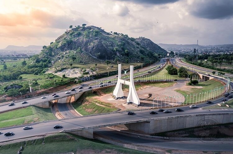
The Federal Capital Territory (FCT)


History
The Federal Capital Territory was created upon the promulgation of decree number 6 of 1976. It came into existence due to a need to find a replacement for the capital city of Lagos, which had become congested and had little space for expansion. The area chosen for the new capital was principally home to the indigenous tribes of Gbagyi, Ganagana, Igbiras, Gede, Bassa, Gwandara and Nupe tribes with a high concentration of Muslims and Christians and high degree of neutrality from other ethnic groups from other parts of the country. It is estimated that currently, the FCT has a population of nearly 2 million.

Geography
Lying between latitudes 8.25 and 9.20 north of the equator and longitudes 6.45 and 7.39 east of Greenwich Meridian, the Federal Capital Territory is geographically located at the center of the country, occupying a landmass of approximately 7,315 km.
Like some northern states in Nigeria, the weather in Federal Capital Territory is relatively mild but usually very hot between the months of January and April. The average daily maximum temperature of the city is above 30 °C or 86 °F, with the month of March being the hottest month. The rainy season in the Territory lasts between April and October of every year but the coolest month is December, which is characterized by windy and foggy atmosphere.
The Territory consists of 6 Area Councils, 62 wards and 17 graded chiefdoms. The Area Councils are:
Abaji
Abuja Municipal
Bwari
Gwagwalada
Kuje
Kwali

Land Administration
Decree 6 of 1976 gave the federal government rights over land within the Territory and produced a detailed plan referred to as the Abuja Master Plan in February 1979 to provide the guide for implementation of all developmental activities.

Agriculture
From the masterplan, out of an estimated land area of 800,000 hectares, 274,000ha is earmarked for Agricultural development, 270,000ha for forest reserves, while 60,000ha is set aside for natural resources (Rivers and Hills).
The masterplan made provisions for extensive farming both under rain fed and irrigation in consonance with the agro-ecological situation of the Territory. The abundant farmland is fertile and sustains production of major crops and livestock in which the FCT has comparative advantage.

